Conrad, O., Bechtel, B., Bock, M., Dietrich, H., Fischer, E., Gerlitz, L., Wehberg, J., Wichmann, V., and Böhner, J. (2015): System for Automated Geoscientific Analyses (SAGA) v. 2.1.4, Geosci. Model Dev., 8, 1991-2007, doi:10.5194/gmd-8-1991-2015. Download.
Fisher, R., Hobgen, S., Mandaya, I., Kaho, N.R. and Zulkarnain (2017): Satellite Image Analysis and Terrain Modelling - A practical manual for natural resource management, disaster risk and development planning using free geospatial data and software. pdf.
Sous, R. (2016): User Guide for SAGA - PT-BR, a translation and update of the SAGA User Guide (Cimmery 2007-2010) to Portuguese of Brazil
Brenning, A. and Bangs, D. (2015): Introduction to Terrain Analysis with RSAGA: Landslide Susceptibility Modeling. pdf.
Svidzinska, D. (2014): Methods of Geoecological Research: A Geoinformational Tutorial with the Open Source GIS SAGA. Kyiv, Logos, 402p. (in Ukrainian). pdf.
Cimmery, V. (2007-2010): SAGA User Guide, updated for SAGA version 2.0.5.
Ipponich, A. (2006): Etude de quelques fonctionnalités du logiciel SAGA GIS. pdf.
Olaya, V. (2004): A Gentle Introduction to SAGA GIS. pdf.

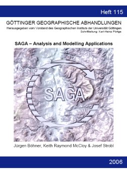
Böhner, J., McCloy, K.R., Strobl, J. [Eds.] (2006): SAGA � Analysis and Modelling Applications. Göttinger Geographische Abhandlungen, Vol.115, 130pp. download editorial

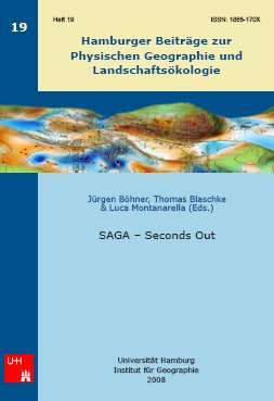
Böhner, J., Blaschke, T., Montanarella, L. [Eds.] (2008): SAGA � Seconds Out. Hamburger Beiträge zur Physischen Geographie und Landschaftsökologie, Vol.19, 113pp. download editorial
Bock, M., Böhner, J., Conrad, O., Köthe, R., Ringeler, A. (2007):
Methods for creating Functional Soil Databases and applying Digital Soil Mapping with SAGA GIS.
In: Hengl, T., Panagos, P., Jones, A., Toth, G. [Eds.] 2007. Status and prospect of soil information in south-eastern Europe: soil databases, projects and applications. EUR 22646 EN Scientific and Technical Research series, Office for Official Publications of the European Communities, Luxemburg, p.149-162
pdf.
Bolch, T. (2006):
GIS- und fernerkundungsgestützte Analyse und Visualisierung von Klima- und Gletscheränderungen im nördlichen Tien Shan (Kasachstan/Kyrgyzstan) - mit einem Vergleich zur Bernina-Gruppe/Alpen.
electronic doctoral dissertation, University of Erlangen-Nürnberg.
pdf.
Bolch, T., Kamp, U. (2006):
Glacier Mapping in High Mountains Using DEMs, Landsat and ASTER Data.
Grazer Schriften der Geographie und Raumforschung, Vol.41, pp.37-48.
pdf.
Conrad, O. (2007):
SAGA - Entwurf, Funktionsumfang und Anwendung eines Systems für Automatisierte Geowissenschaftliche Analysen.
electronic doctoral dissertation, University of Göttingen.
pdf.
Conrad, O., Krüger, J.P., Bock, M., Gerold, G. (2006):
Soil Degradation Risk Assessment Integrating Terrain Analysis and Soil Spatial Prediction Methods.
Proceedings of the International Conference "Soil and Desertification - Integrated Research for the Sustainable Management of Soils in Drylands",
5-6 May 2006, Hamburg, Germany. Internet-Publication edited by the Coordination of Desert*Net Germany.
pdf.
Hengl, T. (2007):
A Practical Guide to Geostatistical Mapping of Environmental Variables.
Scientific and Technical Research series, EUR 22904 EN,
Luxembourg: Office for Official Publications of the European Communities, 143pp.
pdf.
Hengl, T., Grohmann, C.H., Bivand, R.S., Conrad, O., Lobo, A. (2009):
SAGA vs GRASS: A Comparative Analysis of the Two Open Source Desktop GIS for the Automated Analysis of Elevation Data.
Geomorphometry 2009 Conference Proceedings In: Geomorphometry 2009, Edited by R. Purves, S. Gruber, R. Straumann and T. Hengl. University of Zurich, Zurich, 2009, pp.22-27.
pdf.
Kaye, S. (2010):
Can Computerized Terrain Analysis Find Boudica's Last Battlefield?.
British Archaeology, September October 2010, pp.30-33.
pdf.
Kopecky, M., Macek, M., Wild, J. (2021):
Topographic Wetness Index calculation guidelines based on measured soil moisture and plant species composition.
Science of The Total Environment, Volume 757, 143785.
pdf Elsevier.
pdf RG.
Krüger, J.-P. (2006):
Waldkonversion und Bodendegradation im tropischen Tiefland von Ostbolivien -
GIS-gestützte Analyse zur Regionalisierung der Bodendegradation im Department Santa Cruz.
electronic doctoral dissertation, University of Göttingen.
pdf.
Milevski, I., Dragicevic, S., Kostadinov, S. (2007):
Digital elevation model and satellite images in assessment of soil erosion potential in the Pcinja catchment.
Annual of Serbian Geographic Association, Book LXXXVII-No 2, Belgrade, 11-20.
pdf.
Roecker, S.M., Howell, D., Haydu-Houdeshell, C.A., Blinn, C. (2008):
Comparison of Conventional and Pedometric Approaches for Mapping Soil Types.
Mojave Desert DSM Project.
pdf.
Schauppenlehner, T. (2008):
Geostatistische Analysen zur Integration von Geländemodellen und Bodenschätzungsdaten für verbesserte digitale Bodenkarten am Beispiel einer alluvialen Landschaft.
electronic doctoral dissertation, Universität für Bodenkultur, Wien. 133pp.
pdf.
Soria-Auza, R.W., Kessler, M., Bach, K., Barajas-Barbosa, P.M., Lehnert, M., Herzog, S. & Böhner, J. (2010):
Impact of the quality of climate models for modelling species occurrences in countries with poor climatic documentation: a case study from Bolivia..
Ecological Modelling, 221: 1221-1229.
pdf.
Stock, I. (2005):
Vergleich von Segmentierungsprogrammen für hochauflösende Satellitendaten am Beispiel einer Quickbird-Aufnahme von Zentral-Sulawesi, Indonesien.
Bachelorarbeit am Zentrum für Informatik an der Georg-August-Universität Göttingen. 52pp.
pdf.
Varga, K., Becht, M., Damm, B. (2006): Ansätze der GIS-gestützten räumlichen Modellierung von Rutschgefahren in Buntsandsteingebieten Nordhessens und Südniedersachsens (BRD). Angewandte Geoinformatik, 2006:679-684
Wichmann, V. (2006):
Modellierung geomorphologischer Prozesse in einem alpinen Einzugsgebiet -
Abgrenzung und Klassifizierung der Wirkungsräume von Sturzprozessen und Muren mit einem GIS.
Eichstätter Geographische Arbeiten, Vol. 15, Profil Verlag, Munich/Vienna, 231pp.
Hartmann, N. (2007): Geschäftsmodell GNU - macht sich freie Software bezahlt?. Interview mit R.Köthe. FORUM der Geoökologie, Vol.18, No.3, pp.17-18. pdf.
Dugdale, L.J., Brown, J., Lane, S.N., Maltby, A. (2006): R.A.R.E - Rapid Assessment of River Environments. pdf.